Satellites reveal NZ’s coastal health
2 min read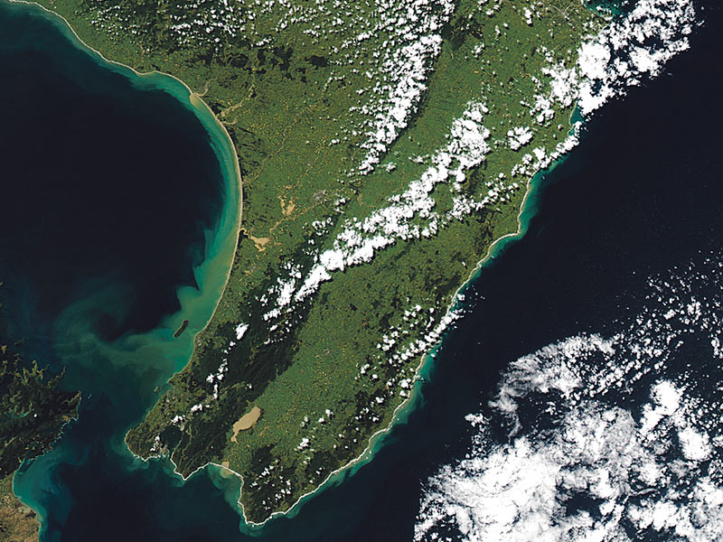
Satellites used to track coastal water health around Aotearoa. Photo: Supplied
In a first for New Zealand, satellites have been used to track coastal water health around Aotearoa.
In a new report commissioned by the Department of Conservation (DOC), NIWA analysed satellite images to measure changes in suspended sediment – or total suspended solids (TSS) – in the country’s coastal waters.
“TSS contains a variety of materials, such as mud and silt, microalgae, and their breakdown products. High concentrations of TSS can cause problems for estuaries, coasts and oceans, and aquatic life,” said NIWA.
By looking at nearly 20 years of monthly satellite images of New Zealand’s coasts, scientists found varied trends in TSS over time across the country, with generally increasing concentrations around the South Island and decreasing concentrations around the North Island.
“High TSS can affect the ability of marine life, such as little blue penguins, to catch food. It can also block light from reaching underwater plants and is associated with elevated levels of pathogens, nutrients, and pollutants,” said NIWA.
DOC technical advisor Helen Kettles said that too much sediment reaching coastal waters is a serious threat to marine life.
“This research helps us to understand which coastal areas are likely to benefit from improved conservation efforts and track how conditions change with time. It is good to know more about how useful satellite monitoring for water clarity will be in the future.”
NIWA principal scientist for remote sensing Dr Matt Pinkerton added that these trends are driven by a combination of factors.
“We suspect that changes in phytoplankton across the New Zealand shelf because of climate variability and change, the effects of waves and coastal storms on coastal erosion and resuspension of seabed sediment, and changes to land use are all influencing these broad-scale trends. On a smaller level, what’s happening in catchments and in rivers is affecting downstream water clarity in estuaries and on the coast.
“Because of the damage TSS can cause at high concentrations, there is concern about the ecological and environmental effects of it on our coastal marine area. This is particularly pertinent because of the severe winter weather we just experienced – steady rainfall doesn’t necessarily impact the concentration of sediment in our oceans, but huge storms like the one the South Island experienced in August can
have a big knock-on effect,” said Dr Pinkerton.
The team used NASA’s Aqua MODIS satellite, which images the entire Earth’s surface every one to two days. The data is free to use and has been used to study a wide range of topics, including glacier surface elevation and even Iberian wolf pack size. In New Zealand, it has been used to monitor changes in ocean primary productivity for environmental reporting.
NIWA’s report details 15 recommendations to improve the value of satellite remote sensing over the next five years. These include the continued use of satellite data alongside in situ sampling and modelling to develop the best insights and management of coastal suspended sediment in the future.